Phu Thap Boek
Phetchabun, Thailand
Sign In to get the latest weather!
It's free to join spedmo and start collaborating
Current Conditions
No Alerts.
Remember before every flight, check your equipment, reassess the conditions and ask yourself if 'I'm safe'?


Required Launch Wind Direction

Facebook group: https://www.facebook.com/groups/399419426852324/
Aaron Hughes added this


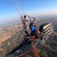
My paragliding trip to Phu Thap Buek PTB) Thailand from 27th Dec 2014 to 2nd Jan 2015. Had many great flights. Touched cloud base for the first time.
Aaron Hughes added this
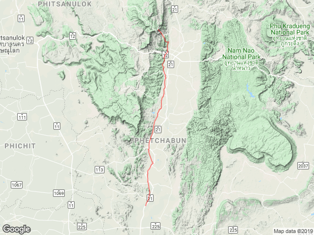
Take Off
16.8981, 101.109 : 1582.0 m
Sunrise
5:51 AM
Sunset
6:52 PM
Time Zone
Indochina Time (+0700)
Warning: As of 2015, the launch has been mostly taken over by a major expansion of a small tourist resort. Launch is becoming too small and unsafe due to many obstacles, buildings of various sizes and various post and fences completely in the way. They ruined it. There is still a small field which can be used adjacent to the diminishing launch (now a dusty parking lot) but may require a full on forward launch for proper take off. I heard they plan to build on the field too (bummer!). This is a very nice site which is disappearing due to poor communication and lack of judgement between the landowners, local pilots, local governments and especially the Thai paragliding officials. A very sad turn of event for paragliding in Thailand! Launch can be tricky. Many serious accidents so far so not a beginner site! This launch is not forgiving so you better be prepared, talk to the local pilots first. Quite far from the take off. But there are options to land close to the road going up although they are not so perfect. There is a risk of not making it there since the sinks can be quite big and drastic at time. Many places to bail out if you know what you are doing. You should be able to make it to the 'gas station' (landing area) most of the time. Follow the road on google map. VERY Easy to hitchhike up the mountain. Paved road to the top! Airport located North of the town of Petchabun (25km south from launch). No idea what are the regulations regarding that. Thermals are more than likely to the west of it near the ridge so that seem far enough away from the airport. No complaints so far... Airport located North of the town of Petchabun (25km south from launch). No idea what are the regulations regarding that. Thermals are more than likely to the west of it near the ridge so that seem far enough away from the airport. No complaints so far...
Potential storm cells forming over the launch at times so be careful and watch for these budding electric storms! Can be tricky down in the valley when the dust devils gets going but this does not seem to happen very often.